We're conducting outreach for the Embarcadero Connectivity Plan and we want to learn more about how people connect to and travel along the Embarcadero today. This is just the first phase of working with the public to shape long-range transportation planning for this part of the city.
You can learn more about the project on this page or by reading our recent blog post. You can also take our online survey at SFMTA.com/EmbarcaderoSurvey to let us know what you think. The survey will remain open through Jan 31.
The Port of San Francisco, in partnership with the U.S. Army Corps of Engineers, is currently working on the San Francisco Waterfront Flood Study, a plan to defend a portion of our city's waterfront against sea level rise, stormwater flooding and earthquakes.
As this critical work unfolds, the SFMTA will work with the community to develop the Embarcadero Connectivity Plan, a long-range transportation plan to keep the Embarcadero moving and thriving for generations to come. Our shared goal is to emerge on the other side of the Port's future work along the Embarcadero with an improved and resilient public transportation system that serves San Francisco residents, businesses and visitors alike.
Together, the Port and SFMTA projects play an important role in protecting vital transportation infrastructure that is used by hundreds of thousands of people each week. This includes the Ferry Building and terminals, the F Market & Wharves Streetcar, BART and Muni’s Embarcadero Station, as well as local streets, bikeways and promenades.
In partnership with the community, the SFMTA and its partners will develop a plan to:
- Address potential transportation impacts from the Port's future work along the Embarcadero
- Propose strategic improvements to the transportation network
- Envision a future waterfront transportation network that will benefit generations to come
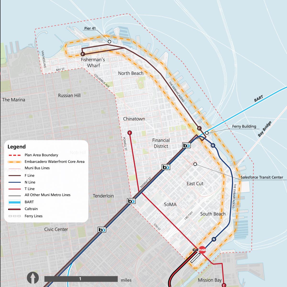
Where: The plan area includes the stretch of waterfront along the Embarcadero from Aquatic Park to Mission Creek, and the bordering communities of North Beach, Chinatown, the Financial District, SoMa and South Beach.

When: Planning efforts are in progress as shown in the timeline and will conclude in Fall 2027.
- Planning
We want to hear from you!
We invite everyone to help us develop this long-range plan. This is a once-in-a-lifetime opportunity to reimagine the transportation system along and connecting to the Embarcadero.
Sign up for project updates to stay informed and to learn about upcoming opportunities to take part in the planning!
If you have questions or would like to request a meeting with the project team, please email us at embarcaderoconnectivity@sfmta.com.
