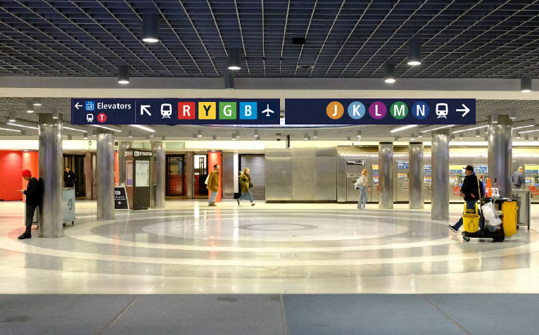
Help us shape the future of transit wayfinding in the Bay Area – learn how to share feedback on test signs at Powell Station. Rendering courtesy of the Metropolitan Transportation Commission.
Muni riders have an exciting opportunity to help improve how people make their way around the Bay Area on public transit.
Starting today, you will begin to see a few test signs at Powell Station in San Francisco. These signs are part of a Bay Area-wide test of the Regional Mapping and Wayfinding Project.
The Regional Mapping and Wayfinding Project is being led by the Metropolitan Transportation Commission (MTC) in partnership with Bay Area transit agencies. The goal of the project is to make maps, signs and other transit communications clearer and more consistent throughout the region. This make it easier for public transit riders to get where they need to go throughout the Bay Area.
In this blog, you’ll learn:
- What to expect from the test signage – and how to share feedback
- Why the Regional Mapping and Wayfinding Project is important
- Why Muni is proud to be a partner in this project
- How your input can shape transit signs and maps across the Bay Area
Wayfinding test at Powell Station: What to expect
You may notice new wayfinding signs inside Powell Station and at transit stops on nearby streets. Because this is a test, the new signs are made of temporary materials and will only be in place for a short time.
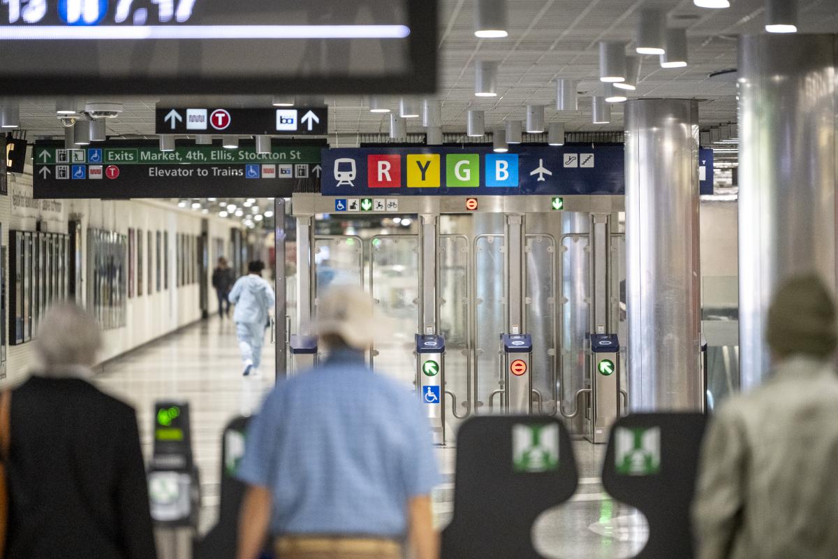
The new wayfinding test will include signs with icons designed to help riders get where they need to go on Muni and BART. You’ll see:
- Redesigned street-level signs at bus stops
- New signs at the Hallidie Plaza entrance to Powell Station
While the signs are in place, survey teams will collect rider feedback. The survey team may ask questions like:
- Are the new symbols for different modes of transit clear?
- Do the new signs make it easier to understand where to go for BART trains and where to go for Muni trains?
- What would make the signs better?
Your answers will help guide the project team’s decisions about how these signs will look when they are rolled out throughout the entire Bay Area.

Transit riders exit through the Muni Metro fare gates at Powell Station near new test signs from the Regional Mapping and Wayfinding Project. Photo by Karl Nielsen, MTC.
The importance of regional wayfinding
The term “wayfinding” means helping people find their way, especially when they’re using public transit. Good wayfinding uses signs, maps, colors, images and simple language to guide riders clearly and quickly.
The Bay Area is a big place. The region is served by over two dozen public transit agencies. Some of these agencies, like BART and Caltrain, serve multiple counties.
Other agencies, like Muni and SamTrans, serve just one county. All these agencies use similar wayfinding systems to guide riders. But none of their wayfinding systems are the same.
The Regional Mapping and Wayfinding Project aims to create a system that is more consistent across all Bay Area transit agencies. It is part of a bigger effort we're working on with MTC and other transit agencies to make riding transit around the Bay Area feel easier and more connected. Some examples of ways we’ve worked with MTC and other transit operators to simplify Bay Area transit include:
- Decreasing the cost of transit trips that use multiple systems through programs like the Clipper BayPass Pilot and the Clipper START Pilot
- Creating schedules that line up better between different transit agencies
MTC is performing tests of the Regional Mapping and Wayfinding Project at two other transit hubs in the Bay Area. But the test at and around Powell Station is particularly important. That’s because Powell Station is one of the most complex transit hubs in the entire Bay Area.
Powell Station has three underground levels. It provides connections to BART and Muni Metro trains. At street level, it connects to Muni bus service, the historic F Market & Wharves streetcar and the iconic Powell Street Cable Car Turnaround.
If a new regional wayfinding system can work at Powell Station, it can work anywhere!

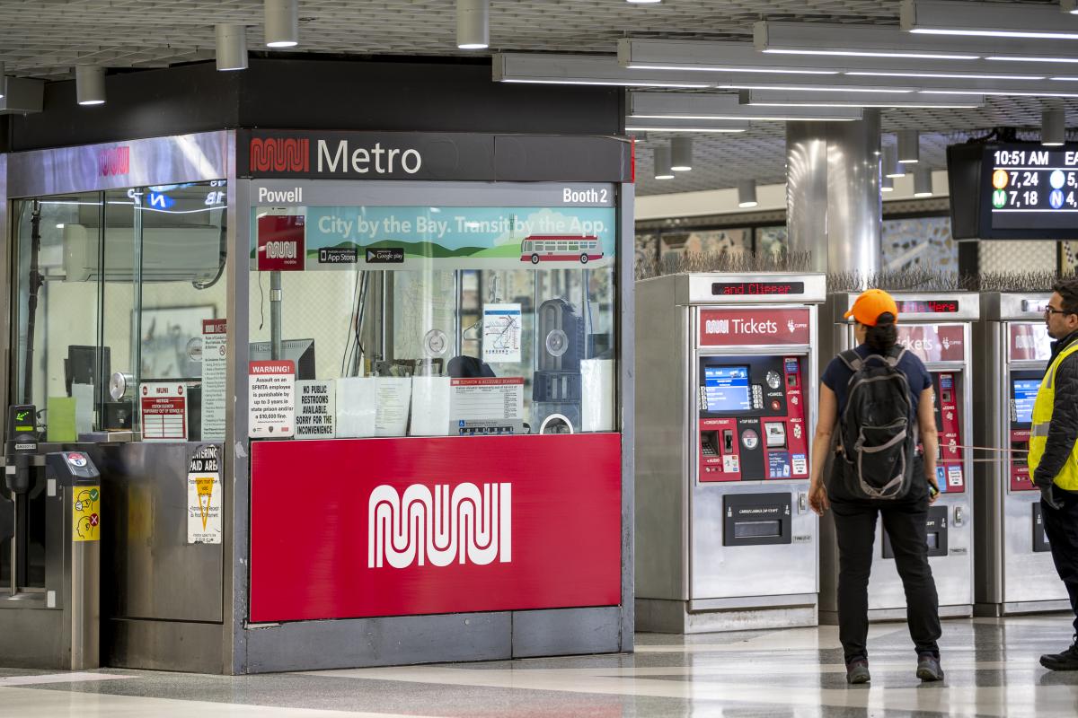
A test banner on the Muni station agent kiosk at Powell Station is part of the Regional Mapping and Wayfinding Project designed to help transit riders. Photo by Karl Nielsen, MTC.
Join us: Your voice matters
Muni is proud to be a key partner on this project. We’ve been focusing on wayfinding for years — and we’re excited to share what we’ve learned.
Since 2014, the SFMTA has worked to make Muni signs and maps easier to understand and accessible to all. Our systemwide wayfinding efforts include using:
- Simple language and including translations when possible
- Pictures and symbols to make signs easier to understand
- Colors, symbols and other visual elements on our maps, so they are easier to quickly understand
In 2021, we started using an internationally recognized wayfinding system at Muni Metro stations. These signs follow the same design rules used at other public transit stations around the world.
We invite you to join us in shaping the future of transit in the Bay Area. Your feedback during this test can help improve signs, maps and wayfinding tools for years to come.
We expect that MTC survey teams will be collecting feedback at and around Powell Station on June 7 and June 10.
You can learn more about the project by visiting MTC’s Regional Mapping and Wayfinding Project webpage and provide feedback using the online comment form.
Comments are for the English version of this page.