The M Ocean View Line turned 100 years old on October 6! To celebrate this centennial, we are kicking off a two-part blog series on the M. Explore this 100-year history in part one.
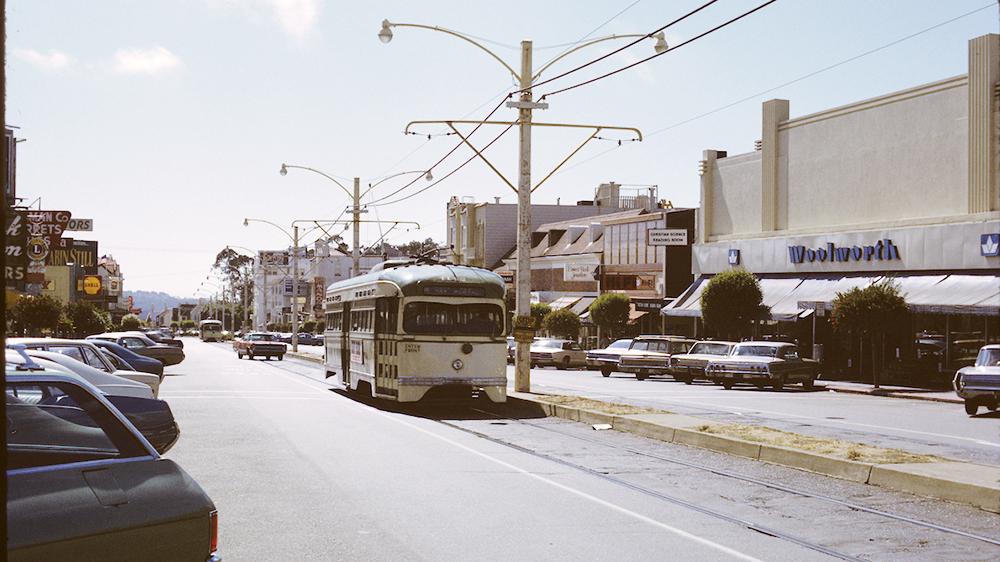
An M Line streetcar heads down West Portal Avenue in this September, 1972 photo.
Before the M
The area surrounding the M Ocean View was largely undeveloped farmland until well into the 20th century. Since the 1860s, passenger trains to and from San Jose stopped nearby but service was infrequent and slow. In the early 1900s, electric streetcar lines skirted today’s Oceanview on San Jose Avenue and Ocean Avenue. This helped drive growth in the area: streets, housing and other infrastructure. The core area now served by the M remained without service.
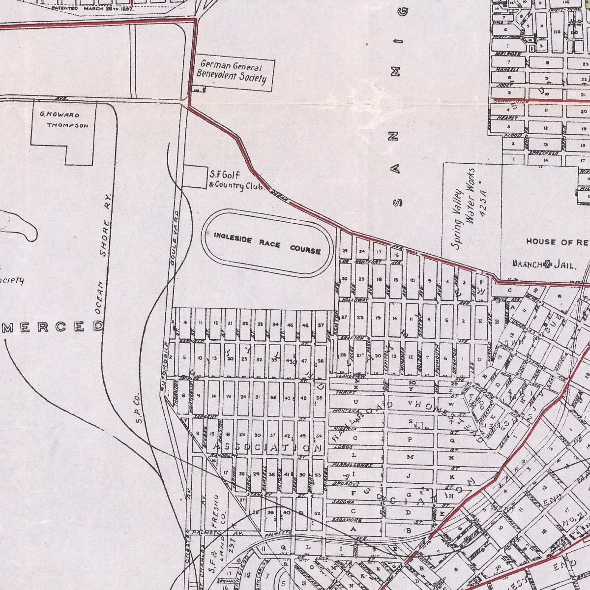
This 1910 map shows the area surrounding the M Line. Red lines show streetcar lines. Two steam train lines are shown as solid black lines. Most of the streets seen here were only plans on a map and remained unpaved for decades. Map courtesy David Rumsey Map Collection, David Rumsey Map Center, Stanford Libraries.
The M Line proposed and built
Muni opened the K Ingleside in 1918 and the L Taraval 1919, its first lines west of Twin Peaks. With the K and L in operation, Muni was looking to further expand service in the southwest part of the city. The M was proposed as an extension with two different plans. One plan charted it from the K Line terminal on Brighton and Grafton. The route would snake downhill through mostly empty lots to Randolph Street. This proposal was rejected due to high cost and slow travel times along the steep route.
A second proposal placed the M on a path west of Junipero Serra Boulevard. This route would be cheaper to build and provide faster service to downtown. This proposal envisioned the M as a branch off a future rapid transit line to the peninsula.
Construction on the M began in early 1924. The M Line split off St. Francis Circle to what would become 19th Avenue. After almost a mile, it wound eastward to Randolph and ended at Broad Street and Plymouth Avenue.
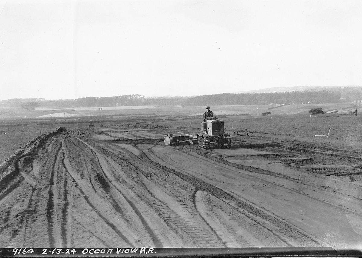
This February 13, 1924 photo shows just how empty the area served by the M was.
A slow start
The M Line opened on October 6, 1925 with little fanfare. In the beginning, it ran only as a shuttle from Broad and Plymouth to the end of West Portal Avenue at St. Francis Circle. Initially, only two streetcars were assigned to the line. For trips downtown, people would transfer to the K Ingleside.
In 1927, Muni partially expanded M Line service through the Twin Peaks Tunnel. Downtown service was only provided on four trips per day, at the beginning and end of the two cars' runs. Full downtown service was not established for nearly 20 years.
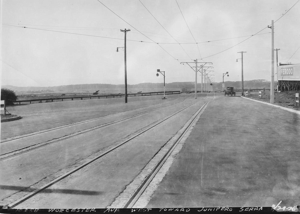
A decade after opening, the M Ocean View rolled through empty land along most of its route. This 1936 view shows the desolate intersection of 19th Avenue and Junipero Serra Boulevard.
Development of the area was slow to take hold and ridership remained low on the M Line. Revenues failed to cover operating costs, and the Great Depression compounded the problem. After 14 years, streetcar service was replaced with the 10 Ocean View bus route in August 1939. Buses were cheaper to operate and were already in use as feeder routes in other areas.
Post-war growth along the M
Demand finally increased during WWII, and Muni brought streetcars back to the M in 1944. Service was restored along the entire line to downtown. After the war, the M Line helped drive development of the Lakeside, Stonestown, Parkmerced and Oceanview neighborhoods.
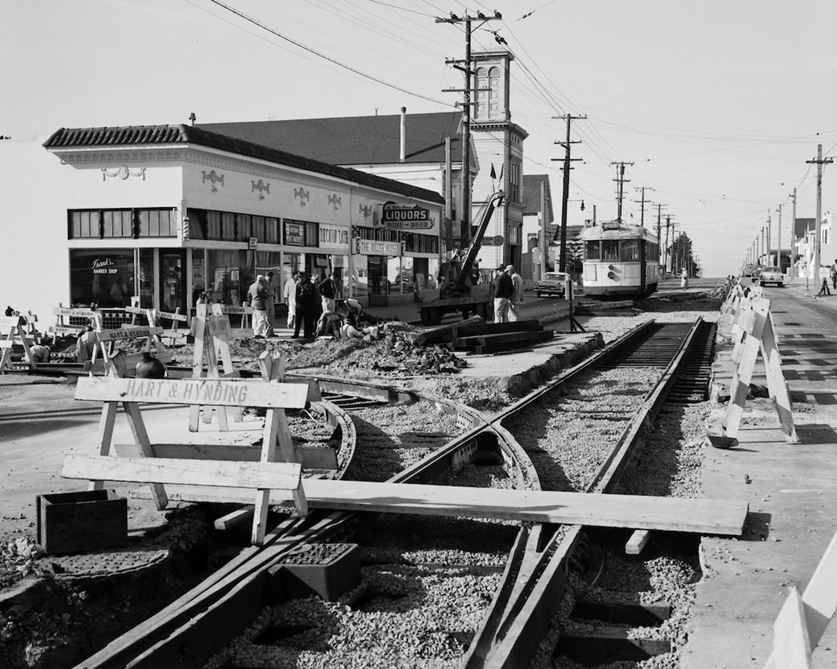
This 1957 photo shows construction of a “wye” track at Broad and Plymouth to improve the M Line terminal.
In 1952 Stonestown Mall and hundreds of adjacent apartments opened. A year later, San Francisco State University opened its new main campus along 19th Avenue. The M quickly became a staple for shoppers and students.
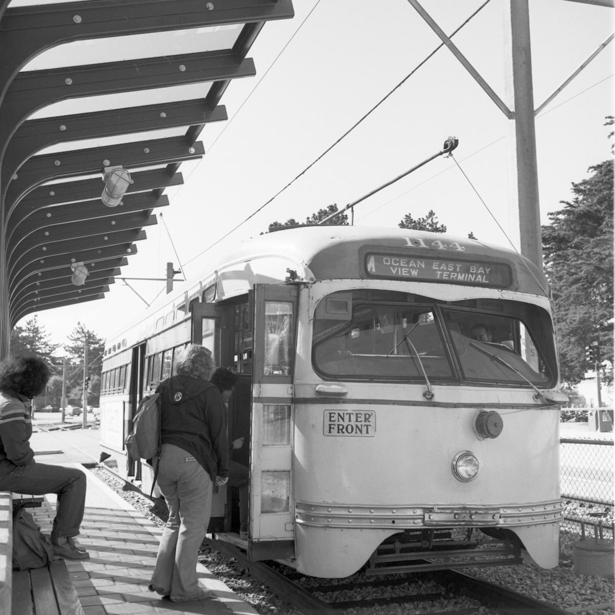
This March 1979 photo shows people boarding an M Line streetcar near St. Francis Circle. Soon, these cars would be replaced with Light Rail Vehicles (LRVs).
Muni Metro extends and modernizes the M
Between 1974 and 1978, service on the M was again replaced by buses. This time, it was for track reconstruction in the Twin Peaks Tunnel and along the M Line for the Muni Metro system.
With the Muni Metro system nearing completion, new ideas to improve the M surfaced. Muni’s 1979 5-year plan included a proposal to interconnect the M with the J Church. This plan would extend tracks on San Jose Avenue to Broad Street and along the Embarcadero to 4th and King. While this exact plan was never implemented, the M Line was extended to Balboa Park along San Jose Avenue that year.
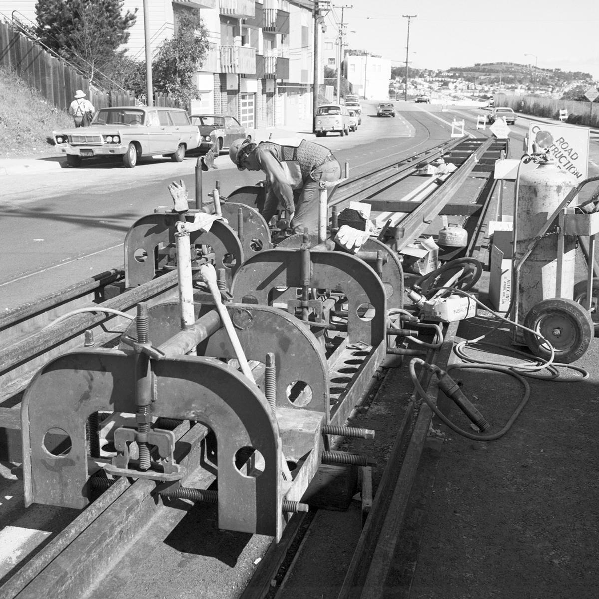
M Ocean View track construction on Broad Street and San Jose Avenue in 1979.
Muni Metro opened in early 1980. By December, the M Ocean View ran on weekdays from Balboa Park to Embarcadero using new LRVs.
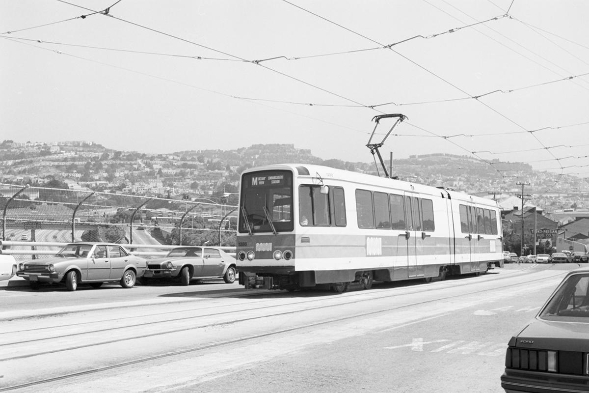
One of Muni’s first LRVs runs on new tracks over I-280 along the M Line extension on San Jose Ave. in 1982.
In 1990, the M was Muni’s second-busiest rail line with close to 32,000 weekday boardings. In 1995, Muni built two new high-level platform stations at the Stonestown and SF State stops.
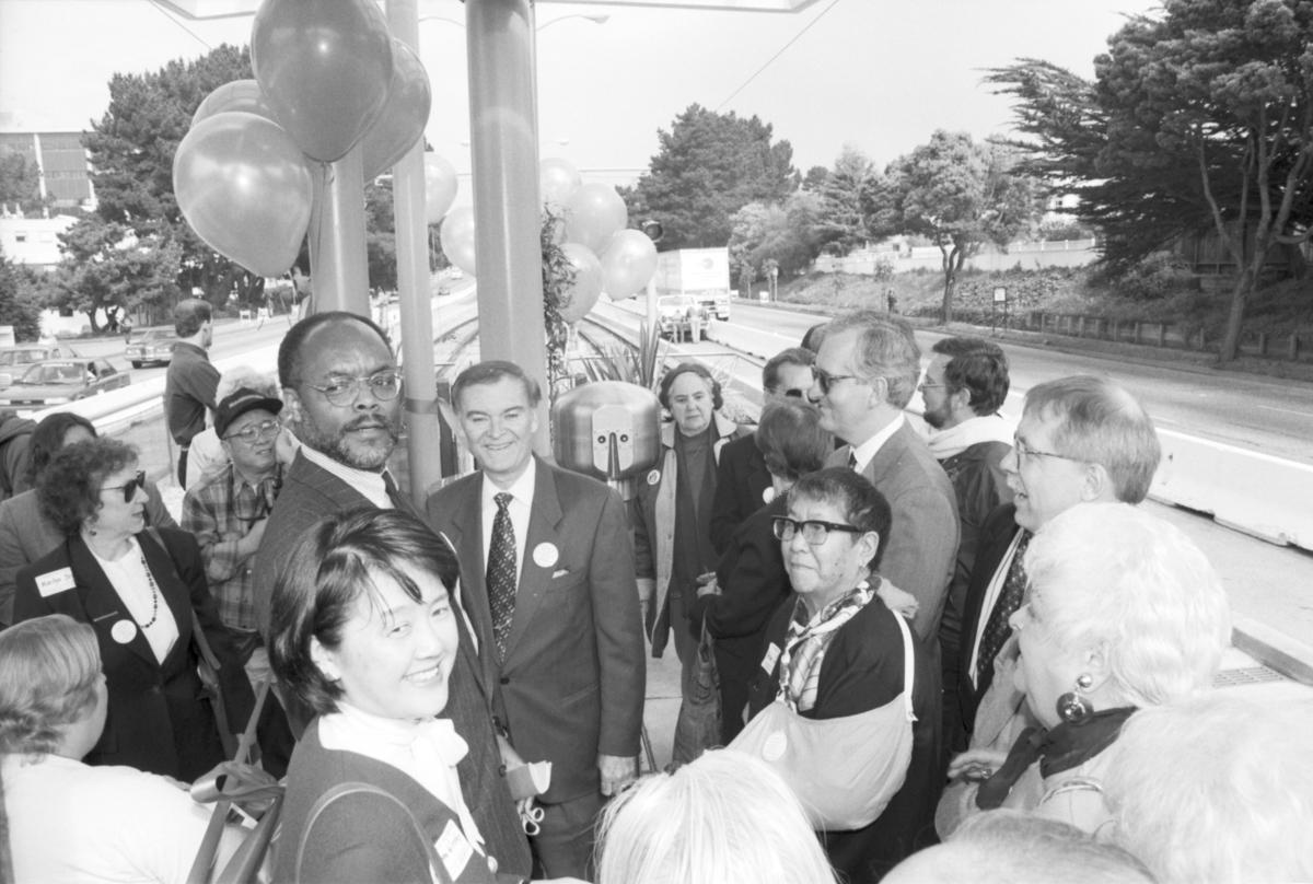
Mayor Frank Jordan (center) and Muni General Manager Philip Adams (left of Mayor) at ribbon cutting ceremony for the new SF State platform.
Opened on March 1, 1995, the stations improved both safety and accessibility at these two heavily used stops.
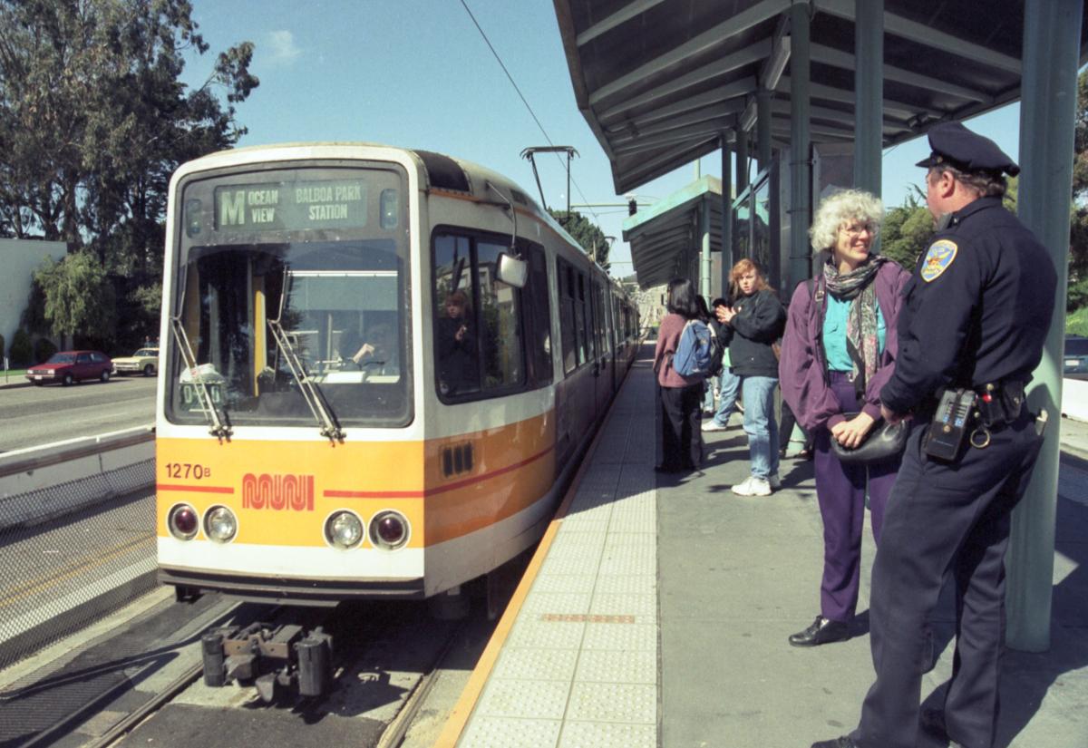
An M Line LRV stops at SF State in this 1995 shot, just two weeks after the station opened.
The future of the M Ocean View
100 years after its opening, we are making more improvements to the M Ocean View. Read all about these and the future of the M in part two of our series, which debuts tomorrow.