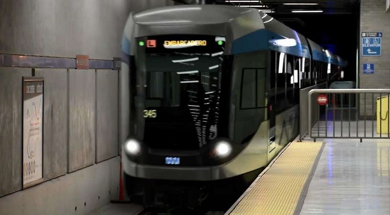
A rendering of one of Muni's new trains at Civic Center Station, as seen in a video produced by Siemens, the train manufacturer.
We want you to help draw the San Francisco subway map of the future.
We’ve teamed up with the San Francisco Planning Department and other city partners to launch a new website where you can help shape the city's plan for future subway — our Subway Vision for the next 50 years. It’s part of the foundation we’re laying for an effective, equitable and sustainable transportation network for the future of San Francisco.
To get this right, we need your input on priorities – whether it’s extending the Central Subway to Fisherman’s Wharf, building a second Transbay Tube for BART into Mission Bay or extending the Market Street subway across the city to allow for longer trains.
The Subway Vision is the first of several components that will make up our long-range transportation roadmap. An ordinance introduced by Supervisor Scott Wiener and passed unanimously by the SF Board of Supervisors in fall of 2015 directed the city to create a framework for subway expansion throughout the city. This is that framework.
San Francisco is growing at a pace not seen in decades. To ensure our city remains vibrant and livable, the SFMTA, Mayor Ed Lee's Office, the Planning Department and the San Francisco County Transportation Authority have been working hard to make sure our transportation system keeps pace.
We’ve done a lot already. The Central Subway tunnels are dug and stations are under construction. We’re replacing the entire Muni bus fleet, and new trains are on the way. We’re creating a Muni Rapid network, and we’re about to break ground for the city’s first bus rapid network on Van Ness Avenue. We’ve also built 30 miles of protected or buffered bike lanes in the last five years, and we’re requiring new building developments to contribute more to help address the transportation demand they create.
But there’s more to be done, so we’re planning for the next 50 years right now - and your input is key.
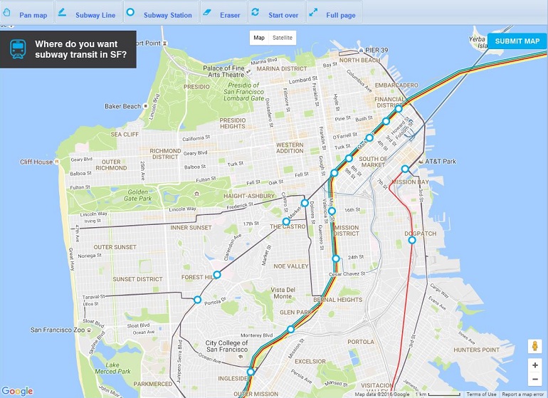
Our new interactive map (seen in this screenshot) lets you draw your vision for future subways in San Francisco.
The Subway Vision is one piece of a new effort to create a broad, long-range plan for all aspects of transportation called Connect SF.
Connect SF is a collaboration between agencies within the city and the region to provide the coordination needed to build the right transportation network for San Francisco in the decades to come.
Through Connect SF, over the next three years we will work to coordinate forward-looking transportation plans and projects, including:
- An overall transportation vision, informed by land use, to guide the future of the city
- An update to the San Francisco Transportation Plan, the blueprint for our investments in our city’s overall transportation system over the next 30 years
- A Transit Modal Concept Study, which will identify the top, initial major transit improvements to invest in within San Francisco
- A Freeway and Street Traffic Management Strategy to improve how the city’s streets and freeways function
- An update to the San Francisco General Plan’s Transportation Element, which helps determine all transportation-related planning decisions in the city
So, why is this effort necessary? Building and managing complex transportation systems requires carefully coordinated planning many years in advance. The more we learn about the priorities, concerns and challenges of today’s San Franciscans, the better we can prepare for our future.
Transportation decisions affect our lives every day, whether we walk, drive, carpool, car-share, bike or take transit. The decisions we make today will have lasting effects for generations to come.
This is our chance to set priorities together, to meet community aspirations, to help get projects built faster and to secure more funding from regional, state and federal sources.
How to Get Involved With the Subway Vision and Connect SF
- Tell us where you want to see San Francisco’s next subways at ConnectSF.org.
- Come to one of our pop-up meetings to learn more and share your ideas. Additional workshops about Connect SF will be scheduled soon.
Help spread the word by sharing the Subway Vision map page and details on social media using the hashtag #ConnectSF.
Let’s get connected.
Read more about the Subway Vision in today's SF Chronicle.